UK Government begins plans to build its first state-owned military satellite network to provide round-the-clock images in all weathers
- Programme ‘Project Oberon’ will work with Airbus to design the small spacecraft
- Satellites will use radars and radio transmissions to identify targets on Earth
- Only advanced spacecraft can take aerial images through cloud and at night
A cluster of military satellites, capable of seeing the Earth’s surface in any weather conditions and at night, are being planned by the UK government.
The programme, known as ‘Project Oberon’ will work with Airbus to design the network of small carbon-fibre spacecrafts as early as 2025.
Using high-resolution radars, the satellites will use radio transmissions to identify targets on the ground and provide aerial images.

The programme, known as ‘Project Oberon’ will work with Airbus to design the network of small carbon-fibre spacecrafts as early as 2025
The spacecraft will also be able to take images through heavy cloud, using radar to pierce through fog and difficult weather.
Only spacecraft equipped with advanced sensors are sensitive enough to the Earth’s surface during nighttime hours.
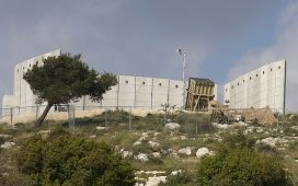
British forces are widening their capabilities to include space technology. They currently rely on information from allies.
Radar satellites are typically large, but the designs, which have already been placed with Airbus, will see small and cost-effective spacecraft developed.

Using high-resolution radars, the satellites will use radio transmissions to identify targets on the ground and provide aerial images
Backed by a £50m commitment by the UK Defence Science and Technology Laboratory (Dstl), it is aimed to boost the military’s future with space.
‘This addition to our capability is a valuable part of the future of defence space. Partnership between Dstl and Airbus on this project secures UK jobs as well as continuing to exploit advances in the UK space sector.’ said chief executive of Dstl Gary Aitkenhead.
Armed forces have previously used data from Britain’s first radar satellite, the NovaSar which was launched last year.

Armed forces have previously used data from Britain’s first radar satellite, the NovaSar (pictured) which was launched last year
It can take pictures of a wide range of terrain on the Earth’s surface in all weather conditions including heavy cloud or at night.
The new satellites would likely use antennas from the Oxford Space Systems (OSS), according to the BBC.
NovaSAR has diverse applications such as ocean surveillance, oil spill detection, flood and forestry monitoring, disaster response and crop assessment.


